During my Erasmus exchange at the TU/e, I was able to experience publishing a paper for the first time. I worked with my two teammates Daan and Jules on a data visualization project, which was started as part of the Algorithms for Geographic Data class.
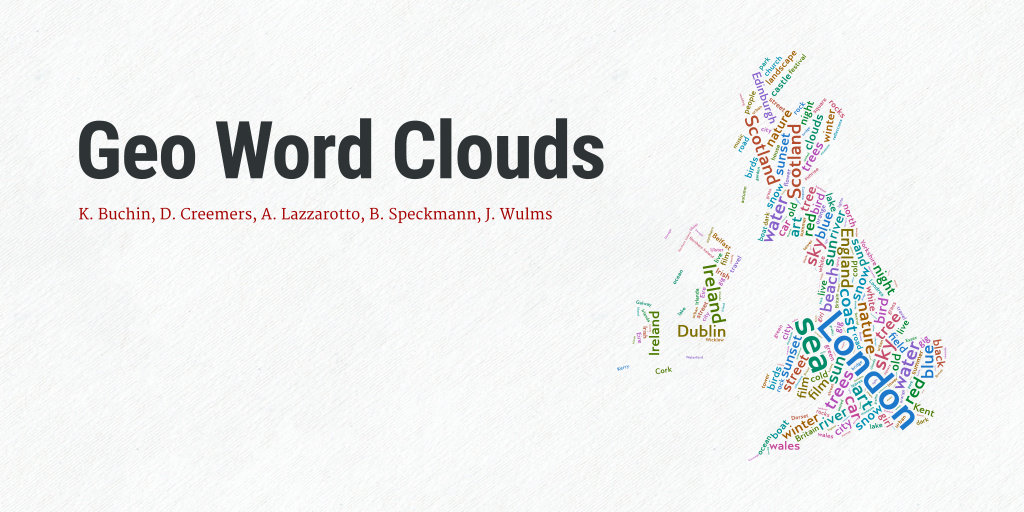
Our work, under the supervision of professors Kevin Buchin and Bettina Speckmann, has been focused on creating word clouds with geographically accurate information. We have called them geo word clouds. The project ended with the preparation of a paper, which was presented at the 2016 IEEE Pacific Visualization Symposium (PacificVis):
Geo word clouds
K. Buchin, D. Creemers, A. Lazzarotto, B. Speckmann, J. WulmsWord clouds are a popular method to visualize the frequency of words in textual data. Nowadays many text-based data sets, such as Flickr tags, are geo-referenced, that is, they have an important spatial component. However, existing automated methods to generate word clouds are unable to incorporate such spatial information. We introduce geo word clouds: word clouds which capture not only the frequency but also the spatial relevance of words. […]
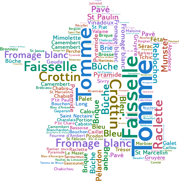
Here you can see a map generated with our algorithm, written using Python and SageMath:
The IEEE Copyright Policy explicitly grants permission for authors to share their papers on personal websites. For this reason, I am sharing the accepted version of the paper together with this notice:
© 2016 IEEE. Personal use of this material is permitted. Permission from IEEE must be obtained for all other uses, in any current or future media, including reprinting/republishing this material for advertising or promotional purposes, creating new collective works, for resale or redistribution to servers or lists, or reuse of any copyrighted component of this work in other works.
You can read the full text PDF here.
